232 claims over almost 4900 acres plus a 15.5-acre patented claim plus a 65 acre patented millsite within 8 miles
Host to 5 past producing silver mines – multiple shafts and over 74 adits
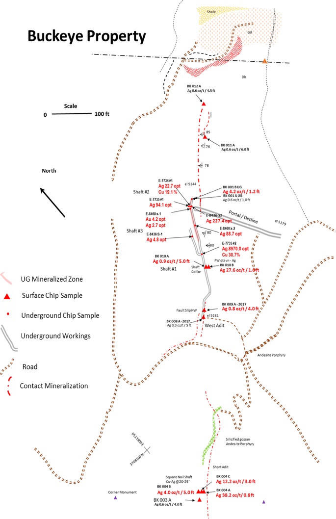
The claims which include the Buckeye Silver Mine are comprised of three non-contiguous patent mining claims, totaling 47.89 acres (19.40 ha), leased in one agreement to the Company. These patents are: The Buckeye of 15.49 acres (6.27 ha), the Newton of 16.69 acres (6.76 ha), and the Red Robin of 15.71 acres (6.36 ha). All these patents were registered in 1887 as shown on their certificates which state shafts, tunnels, levels and open workings on them. The claims are located in Gila County, Arizona approximately 31 km from Globe, Arizona.
History
Silver – 5 historical mines – Multiple shafts and over 74 adits
McMorris Mine 700ft shaft
McCellan Mine 250ft shaft
Silver Seven Mine Adits
La Plata Mine Adits
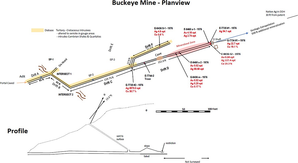
Buckeye Mine Adits
Source of the legendary silver bullets
McMorris Mine produced approx. 500,000 ounces at 250 oz/ton in direct shipping ore until 1893
Mines and veins of area were never fully exploited or explored. 100%- owned Richmond Basin shows significant potential for multi-million ounce silver deposits. In 2017 and 2018 the current Management of Silver Bullet Mines
Drilled 14 holes / 1500 metres
Produced 500 ozs of Silver from the Buckeye Mine
Several majors are in close proximity to Silver Bullet’s flagship property
Buckeye Mine Production
Over 500 oz of silver were produced from Buckeye Mine in 2018 from 5 tons of ore
A high-grade silver vein was accessed from the decline
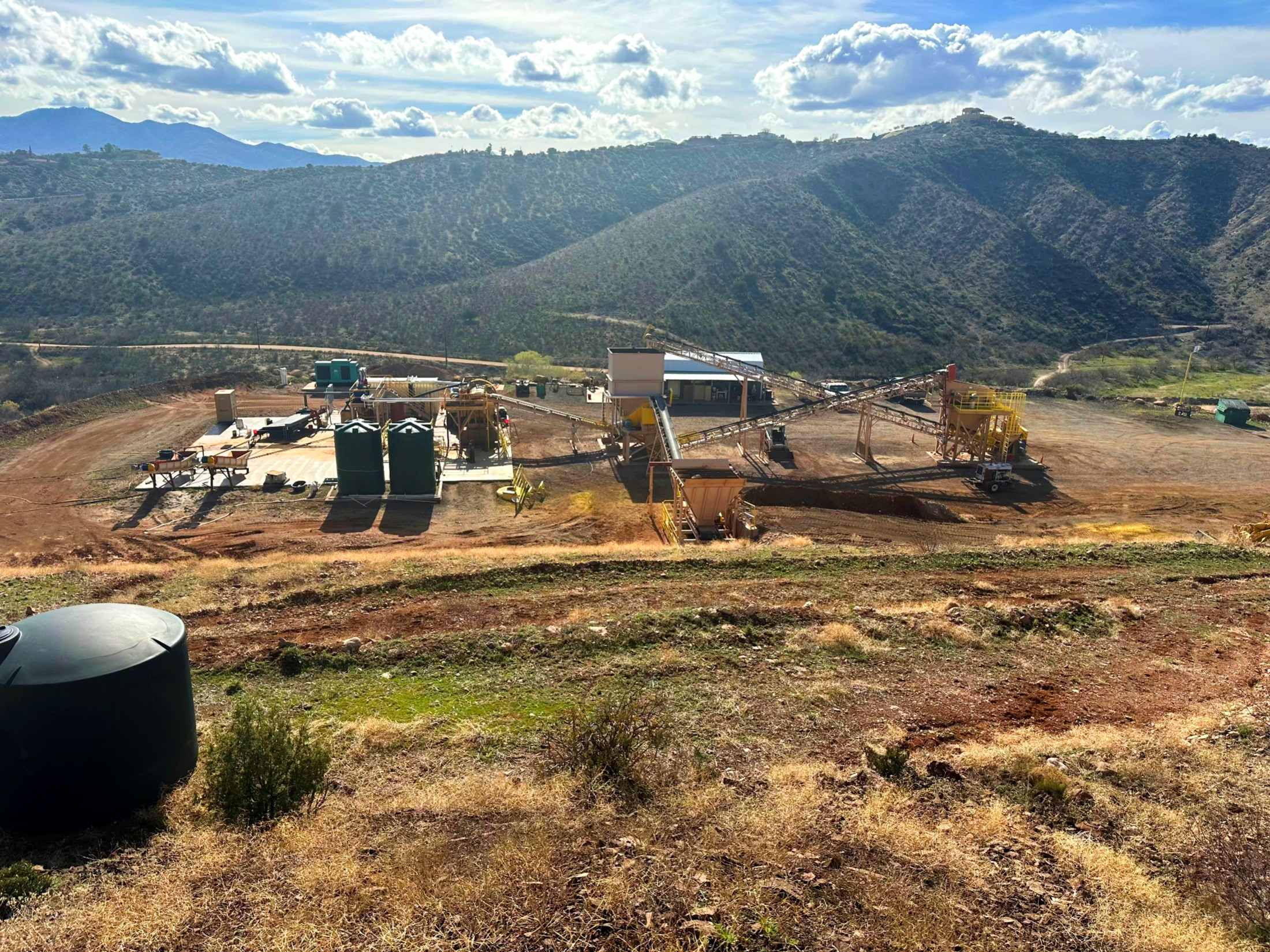
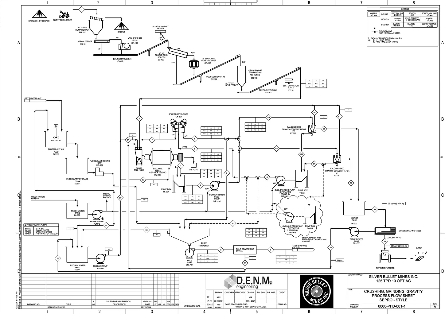
Ore processed at SBMI’s own mill facility with crushing and gravity recovery
Proof concept is complete
125 MTPD gravity mill complete MSHA approved
Mill site
125 tpd processing facility
Full-functioning high efficiency gravity circuit
100 % owned plant and property.
Mine is 8 miles away
McMORRIS MINE
McMorris Silver Mine is also part of Black Diamond
After Buckeye is started, carry out usual exploration work at high grade targets at McMorris
McMorris Mine produced approx. 500,000 oz at 250 oz/ton silver in direct shipping ore from 1875 to 1893
3 levels, deepest shaft to 650 ft
Shear structure over 7200 ft, E-W, and a vein locally greater than 5 feet wide
Grades from underground sampling include 45 oz/ton Silver in ore shoots (non compliant 43-101 historic data)
Average grade in remaining vein estimated at 10 oz/ton Silver (non compliant 43-101 historic data)
Resource potential est. at ~5M oz over a 2800 ft strike length
Additional cross veins and flat veins for resource expansion
Source of the legend of the Lone Ranger’s bullets
McMorris – 1987 Geological Report
Geological report completed in 1987 (predating NI 43-101 so cautions and caveats apply) indicated a gross economic value of US$487.3 million for insitu silver and gold at the McMorris
The author used commodity prices of US$450/oz gold and US$7/oz silver
McMorris area represents only ~21% of SBM’s total land package; more exploration work must be carried out before that report can be confirmed
Copper Porphyry Potential
Potential Copper Porphyry with 3 copper / gold zones identified at the Black Diamond Property:
– Richmond (Richman) Basin
– Buckeye South
– Black Copper
In 2017 and 2018 a soil sampling program was carried out over roughly 10% of Black Diamond that returned areas of anomalous copper. Expansion of the soil sampling program and standard exploration methodologies will help identify mineralization source and style.


